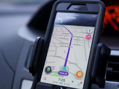
Banning a single consumer navigation app on official duties rarely secures a state's telemetry footprint when the underlying mobile operating systems, cellular networks, and cross-application SDKs remain untouched. In late October 2026, Malaysia ordered civil servants to stop using Waze while carrying out official duties, citing concerns over data security, personal information protection, and the app's origins in Israel—a country with which Malaysia maintains no diplomatic ties. Waze, which was founded in Israel and acquired by Google in 2013, rejected the allegations as false and stated that it operates under strict privacy policies and global legal data protection standards. Meanwhile, Malaysian officials pointed civil servants toward TuJu, a local navigation application developed by the Malaysian Highway Authority.
Standard news coverage treats this dispute as a binary clash between a government claiming security exposure and a technology vendor issuing a flat denial. That framing obscures the actual mechanics of mobile location intelligence. Location data is not a single static file sitting in one vault; it is a continuous stream of coordinates, timestamps, velocity vectors, and behavioral routines that gains strategic value only when aggregated, correlated, and subjected to legal jurisdiction or technical interception.
To evaluate whether restricting Waze on official duty meaningfully reduces state risk, analysts must separate corporate origins from data governance, examine how metadata compounds across populations, and account for the operational trade-offs of switching to a domestic alternative.
Deconstructing the Competitor Narrative
Conventional reporting on the Waze ban relies on three recurring moves that stop short of operational analysis:
- Equating corporate lineage with active exploitation. Articles routinely note that Waze began in Israel and later became part of Google, then pair that history with government warnings about foreign data misuse. Lineage and corporate control affect legal exposure and geopolitical trust, yet they do not by themselves prove unauthorized access or ongoing surveillance.
- Treating Waze as an isolated location source. By focusing almost exclusively on Waze's response and the immediate directive to civil servants, standard coverage overlooks that modern smartphones generate location signals through operating-system services, Wi-Fi and cell tower triangulation, and dozens of background apps even when a driver closes a navigation screen.
- Framing a domestic app as an automatic security upgrade. Mentioning that officials encouraged civil servants to use TuJu treats local software as inherently safer than foreign software. In practice, domestic apps introduce their own engineering, authentication, and data-retention risks, alongside usability gaps that can push employees back toward workarounds.
Three Pillars of Location Telemetry Risk
A rigorous assessment of civil-service navigation use rests on three distinct analytical pillars: Jurisdictional Reach, Aggregate Pattern Inference, and Endpoint & Ecosystem Leakage.
Jurisdictional Reach and Corporate Control
When a government evaluates a consumer app, the first question is not merely what the app collects today, but which legal regimes govern the entity controlling that data. Public reporting on Malaysia's decision highlights two structural layers: Waze's roots and incorporation structure, and its ownership by Google under Alphabet.
In information security and compliance, jurisdictional reach defines which courts, regulators, or intelligence authorities can compel disclosure or shape corporate governance. A company's stated privacy policy reflects contractual and regulatory commitments, which is a known fact asserted by Waze. What remains unverified in public reporting is whether any foreign state has actually obtained or misused Malaysian official travel data through Waze; that remains a hypothesis rather than a proven event. Confusing legal-jurisdictional exposure with confirmed compromise leads to sloppy policy debates on both sides.
Aggregate Pattern Inference
Individual GPS pings often look mundane on their own—a commute along a highway, a stop at a ministry complex, or a detour around congestion. The analytical danger lies in aggregation over time and across cohorts.
When location traces from many public servants are combined, an observer can infer institutional rhythms rather than just personal movements:
- Facility activity spikes. Clusters of arrivals and departures near sensitive ministries, security installations, or logistics hubs can signal crisis meetings, unannounced inspections, or shifts in operational tempo.
- Route predictability. Repeated travel corridors and timing windows create exposure if an adversary seeks to map routine movements of officials or escort vehicles.
- Identifier linkage. Even when an app uses pseudonymous or unique user identifiers rather than real names, repeated co-location with home addresses, workplaces, or known device habits can weaken anonymity.
Notice the cause-and-effect chain here. A single civil servant opening a map to route around traffic poses a low risk on its own. Aggregating thousands of trajectories across sensitive government corridors raises the analytical value of the dataset. A ban limited strictly to official duties targets the official-context slice of that behavior, though off-duty use on personal devices still leaves personal routine data outside official controls.
Endpoint and Ecosystem Leakage
Even if civil servants stop launching Waze during work hours, location risk does not vanish at the app boundary. Modern mobile devices operate as multi-sensor platforms.
- Operating-system and platform telemetry. Mobile operating systems manage GPS hardware, fused location providers, and background diagnostics. If a civil servant uses a personal phone or a poorly managed work phone, location signals can still flow to platform vendors or third-party analytics libraries embedded in other apps.
- Alternative navigation tools. Other mapping services—such as Google Maps when history or activity tracking features are active—present comparable conceptual privacy considerations around location storage and retention policies.
- Behavioral reversion. When an approved tool lags in routing accuracy, traffic freshness, or interface reliability, users frequently revert to familiar tools or share live locations over messaging apps. That human workaround is a classic operational failure mode in security rollouts.
Fact Versus Hypothesis in the Waze Dispute
Clear strategic thinking requires keeping verified facts separate from inferences and unproven claims:
- Known facts. Malaysia barred civil servants from using Waze while carrying out official duties, with leadership citing data security and concerns tied to the app's Israeli origins. Waze denied collecting sensitive government information or enabling personal data exploitation, pointing to its privacy policies and global data protection standards. Officials also pointed toward TuJu, developed by the Malaysian Highway Authority, as an alternative.
- Educated hypotheses. Security analysts note that aggregated location data from public servants could theoretically reveal patterns around government sites, and restricting a single app without publishing a broader comparative risk review across navigation platforms may leave gaps. Conversely, Waze's denial does not guarantee that a future vulnerability or legal demand could never arise, nor does a ban guarantee that civil servants will not leak movement patterns through other apps or unmanaged devices.
- Unproven claims in public reporting. Publicly available reporting does not establish active exploitation of Malaysian government data by Waze or any foreign state. Treating a plausible threat model as confirmed espionage overstates what the evidence supports.
The Cost Function of Switching to TuJu
Promoting a domestic alternative like TuJu changes the risk profile rather than eliminating it. In strategy and operations, every control carries a cost function made up of engineering cost, usability friction, and residual security exposure.
If civil servants are steered toward a local navigation app, three operational variables determine whether the policy succeeds:
- Map and traffic freshness. Real-time routing depends on dense, continuous road telemetry and accurate incident reporting. If a domestic app has fewer active road contributors or slower map updates, travel times degrade.
- Security engineering and data governance. Moving data to a local authority shifts jurisdiction inward, which may align with national sovereignty goals. However, a domestic app must still enforce strong encryption, minimal data retention, strict access controls, and regular security audits—otherwise the state trades a perceived foreign risk for a local engineering vulnerability.
- Device segregation. Applying the restriction to official duties works best when official travel occurs on managed government devices with enforced Mobile Device Management (MDM) policies, rather than relying solely on honor-system compliance across dual-use personal phones.
There is no silver bullet here. A blanket consumer ban across the entire public could spark friction over everyday commuting and broader digital policy, while a narrow official-duty rule leaves off-duty traces untouched. Meanwhile, rushing an immature local app into mandatory service risks poor routing and shadow usage of unapproved tools.
A Four-Step Protocol for Auditing Government Navigation Risk
Rather than stopping at a single-app ban, a disciplined cybersecurity and digital-governance team would evaluate navigation risk through a repeatable four-step sequence:
- Classify personnel and travel tiers. Separate routine administrative commuters from officials whose schedules, locations, or convoy movements carry heightened security sensitivity. High-sensitivity roles require stricter controls than low-sensitivity office commutes.
- Conduct a cross-app technical and legal audit. Evaluate Waze, TuJu, and other widely used mapping and location-sharing apps against identical criteria: data controller jurisdiction, retention windows, sharing with third parties, encryption in transit and at rest, and background location permissions.
- Enforce device and network guardrails. Require managed devices with locked app permissions for official duties, disable unnecessary location history features where permitted, and prohibit sensitive itinerary sharing on consumer messaging apps.
- Benchmark the domestic alternative before scaling mandates. Measure TuJu's routing accuracy, incident coverage, crash rates, and security posture against operational requirements, and publish clear guidance so civil servants understand both the security rationale and the approved workflow.
Strategic Recommendation
Governments and enterprise security leaders should treat the Waze restriction as a baseline hygiene measure on official duties, not a complete location-security strategy. The highest-leverage move for policymakers is to pair the official-duty restriction with a transparent, cross-platform location-risk assessment and rigorous engineering upgrades to TuJu—focusing strict device and routing controls on high-sensitivity personnel and facilities where aggregated movement patterns carry real strategic consequence.