The Resource Asymmetry of Invasive Vector Management
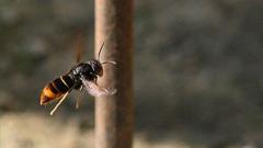
Invasive species control operations face a systemic dynamic: the cost of locating a hidden reproductive nest scales exponentially relative to the cost of destroying an isolated biological vector. In island ecosystems, the introduction of Vespa velutina (the yellow-legged or Asian hornet) represents a direct threat to indigenous pollinator networks and agricultural biosecurity.
When confronting single worker hornets, uncoordinated public intervention—specifically the immediate physical destruction of individual specimens—erases valuable intelligence. Executing a solitary insect offers zero systemic yield while eliminating the only active directional signal pointing toward a primary or secondary colony.
                                [ PUBLIC DETECTS HORNET ]
                                           |
                    +----------------------+----------------------+
                    |                                             |
            [ Immediate Elimination ]                     [ Telemetric Tracking ]
                    |                                             |
          (Loss of Trajectory Data)                     (Vector Trajectory Mapping)
                    |                                             |
          [ Single Vector Terminated ]                  [ Colony Location Pinpointed ]
                    |                                             |
         { Nest Remains Active: }                       { Total Colony Destruction: }
       { ~2,000 New Workers Produced }                 { Systemic Threat Neutralized }
Effective containment strategies require transitioning public behavior from indiscriminate destruction to crowdsourced vector tracking. Preserving worker hornets allows vector control teams to perform visual triangulation, converting isolated encounters into targeted colony destruction.
Vector Dynamics and the Functional Timeline of Expansion
Understanding the lifecycle of Vespa velutina exposes why localized, non-strategic intervention fails to alter ecological outcomes.
SPRING (April–June)              SUMMER (July–September)            AUTUMN (October–November)
+----------------------------+   +----------------------------+   +----------------------------+
|  Emergence & Hibernation  |   |   Secondary Expansion      |   |   Gynoid Production        |
|  - Queens build primary    |-->|   - Worker population     |-->|   - Hundreds of new queens |
|    nests (~100 brood)      |   |     expands (~2,000)       |   |     produced               |
|  - Strategy: Mass Trapping |   |   - Strategy: Triangulation|   |   - Risk: Exponential      |
+----------------------------+   +----------------------------+   |     multiplication         |
                                                                  +----------------------------+
The Spring Queening Baseline
During the initial spring phase, overwintering founder queens emerge to establish primary nests. These early structures, built in sheltered human infrastructure such as sheds, attics, or low vegetation, contain minimal brood populations (typically under 100 individuals). Interception at this phase relies on static bait trapping networks managed by volunteer networks. Trapping data from spring 2026 recorded 205 captured queens and 9 destroyed primary nests across Guernsey and Herm. While these captures mitigate early-stage expansion, uncaptured queens successfully transit to secondary nest construction.
The Summer Secondary Transition
By mid-summer, primary nests are abandoned for high-capacity secondary nests constructed in elevated tree canopies, dense brush, or structural cavities. Populations within these main nests scale to approximately 2,000 active worker hornets. At this inflection point, static spring traps lose efficacy due to competing natural food sources and shifting hornet foraging behaviors.
The Reproductive Multiplication Risk
If a secondary nest survives into late autumn, it produces hundreds of new gynes (potential queens). These gynes disperse, hibernate, and re-emerge the following spring, causing population growth to scale exponentially. Eliminating an isolated worker insect in July has a negligible impact on colony survival; discovering and destroying the secondary nest before the autumn reproductive cycle is the primary lever for population control.
The Triangulation Framework: Converting Sightings into Spatial Intelligence
To convert informal community observations into actionable surveillance data, public engagement strategies must rely on structured data collection parameters.
Primary Vector Telemetry Data Inputs
- Photographic Verification: Distinguishes native species (Vespa crabro) from invasive species (Vespa velutina) to avoid misidentifying beneficial native insects.
- Directional Flight Path (Azimuth): Foraging worker hornets fly in direct lines between resource locations and the nest. Recording the precise compass bearing upon departure provides a linear vector toward the nest origin.
- High-Precision Geolocation: Utilizing precise location protocols (e.g., GPS coordinates, street addresses, or what3words designations) provides a concrete baseline for geographic information system (GIS) mapping.
                     [ Sight Point A ] ------ Vector A -----\
                                                             \
                                                              +--> [ Intersect: Nest Location ]
                                                             /
                     [ Sight Point B ] ------ Vector B -----/
When two or more flight vectors are recorded from separate observation points, vector control operators plot the intersection point on a topographic map. This narrows the physical search grid from several square kilometers to a defined target radius, enabling rapid nest neutralization.
Operational Guidelines for Field Risk Reduction
Invasive hornet management requires balancing vector tracking with public safety and infrastructure protection. Uncontrolled disturbances of active nests create significant biosecurity hazards and risk severe allergic responses or systemic toxicity from repeated envenomation.
Risk Mitigation Protocols for Landowners and Field Operations
- Pre-Clearing Structural Audits: Before executing hedge trimming, forestry maintenance, or demolition, operators must conduct a 5-minute visual sweep for flight lines entering high-density vegetation or outbuildings.
- Disturbance Avoidance: Direct physical contact, application of commercial pesticides, or trampling must be avoided. Vibrations from heavy machinery within 10 meters of an unseen secondary nest can trigger defensive swarm responses.
- Containment vs. Elimination: If an isolated hornet enters a closed space (e.g., an outbuilding or greenhouse), it should be safely contained inside the structure without being crushed. Reporting the precise location enables operators to inspect the site and establish a local bait station to confirm whether a broader infestation exists.
Deploying Strategic Vector Interception
Achieving complete containment requires converting public observations into organized, data-driven reporting channels. Field operations rely on high-volume, precise telemetry to identify flight trajectories before the autumn reproductive transition.
       +---------------------------------------------------------------+
       |             RECOMMENDED OPERATIONAL RESPONSE                  |
       +---------------------------------------------------------------+
       |                                                               |
       |   1. DO NOT DISTURB OR TRAMPLE THE INSECT                     |
       |      Preserve the vector to observe flight trajectory.        |
       |                                                               |
       |   2. CAPTURE HIGH-RESOLUTION VISUAL EVIDENCE                  |
       |      Confirm biological characteristics via photograph.       |
       |                                                               |
       |   3. LOG BEARING AND GEOLOCATION                              |
       |      Note flight path direction and exact coordinates.        |
       |                                                               |
       |   4. TRANSMIT DATA IMMEDIATELY TO CONTROL UNITS               |
       |      • Email: asianhornet@gov.gg                              |
       |      • Direct Telemetry Line: 07839 197082                   |
       |                                                               |
       +---------------------------------------------------------------+
Submit confirmed observations directly to the Invasive Non-Native Species Coordination Strategy via asianhornet@gov.gg or the field dispatch line at 07839 197082. Ensure all data transmissions include visual verification, radial coordinates, and precise time stamps to maintain mathematical integrity across the spatial model.

/https://i.s3.glbimg.com/v1/AUTH_e84042ef78cb4708aeebdf1c68c6cbd6/internal_photos/bs/2026/g/B/3vpkvHQKizRKAfzDxjXA/vini-jr-antes-e-depois.jpg)