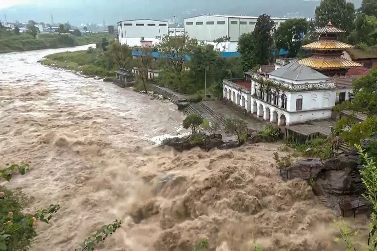
Every monsoon season across the Himalayan arc follows a predictable, terrifying rhythm. Torrential downpours lash steep mountain flanks, soil saturation reaches breaking point, and hillsides give way without warning, burying highways, sweeping away settlements, and claiming human lives with grim regularity. Recent reports from Nepal highlighting fourteen deaths within a compressed seventy-two-hour window due to severe flooding and landslides are not statistical anomalies. They represent the predictable outcome of a deeply entrenched ecological and structural failure that has persisted for decades. When fourteen lives vanish in three days across districts already battered by erratic weather, public discourse usually fixates on the sheer volume of rainfall. Yet rain alone does not kill. Gravity acting upon deforested slopes, unscientific road excavation, and reactive disaster management systems creates the conditions for catastrophe long before the first storm cloud gathers.
The Anatomy of a Himalayan Disaster
To understand why Nepalese topography transforms into a lethal hazard during heavy precipitation, one must examine the fundamental geology of the region. The young Himalayan mountain range is inherently unstable, composed of highly fractured rock strata and thick sedimentary deposits that are continuously uplifted by tectonic activity. These mountains are essentially growing upward faster than they can consolidate, making them acutely sensitive to external disturbances. For generations, traditional agrarian communities adapted to this volatility by building terraces, preserving deep-rooted forest cover on upper slopes, and locating settlements on stable ridgelines or elevated alluvial fans. Traditional architecture utilized lightweight timber and stone construction that could either withstand minor shifts or be easily repaired.
Modern development has systematically dismantled these ancient buffer mechanisms. Over the past four decades, rapid population growth, unplanned urbanization, and the aggressive expansion of rural road networks through unscientific bulldozer excavation have severely destabilized mountain slopes. Local politicians and road committees often prioritize cheap, rapid connectivity over geological safety surveys. Heavy excavators cut into the toes of fragile hillsides without proper retaining walls, side drains, or spoil disposal management. Tons of loose debris are simply pushed down slope into river valleys, choking natural drainage channels and creating artificial dams of loose earth that inevitably breach when heavy rains arrive. When intense precipitation strikes these compromised slopes, the loose soil behaves like liquid slurry, triggering massive debris flows that travel at terrifying speeds down narrow ravines.
Roads Carved Into Powder and the Myth of All Weather Connectivity
The arterial highway system of the country serves as a primary illustration of this structural vulnerability. Vital trade and transit corridors like the Prithvi Highway, the Tribhuvan Highway, and various segments of the mid-hill highway networks are continually severed by recurring landslides during the rainy months. When a major highway closes due to slope failure, the economic ripple effects are immediate and severe. Fuel, medical supplies, fresh produce, and construction materials get stranded for days. Passenger buses carrying families across provinces find themselves trapped between impassable mudslides with nowhere to turn. Commuters sleep in buses or makeshift roadside shelters, exposed to ongoing rockfalls and rising floodwaters. The standard government response consists of deploying heavy machinery to clear the debris only after the road has already collapsed, treating the symptom while ignoring the structural disease causing the collapse in every heavy downpour.
The Hydraulic Toll of Unregulated Riverbed Extraction
Beyond road networks, the hydrological dynamics of major river basins across the country present another layer of systemic peril. Rivers originating in the high Himalayas—such as the Koshi, Narayani, Karnali, and Mahakali—carry immense sediment loads down to the plains during the monsoon. Unregulated commercial extraction of sand, gravel, and boulders from riverbeds to feed booming construction industries in urban centers has severely altered river morphology. Deep trenching of river channels destabilizes riverbanks, lowers water tables, and accelerates bank erosion during peak flood flows. When swollen rivers burst their dykes or alter their courses overnight, entire agricultural settlements vanish beneath silt and stones. The historical tendency to rely on hard engineering interventions like concrete embankments often proves counterproductive; rivers simply scour deeper foundations or undermine the walls, transferring the destructive energy further downstream.
Drainage Deficits in Rapidly Urbanizing Valleys
Drainage infrastructure across urban centers and rural valleys alike suffers from chronic neglect and obsolescence. Rapid, unregulated real estate development in the Kathmandu Valley and expanding regional hubs like Pokhara, Narayanghat, and Itahari has systematically paved over natural wetlands, agricultural ponds, and seasonal stream beds. Water that used to soak into the ground now rushes across impermeable concrete surfaces in torrents, overwhelming aging municipal storm drains that were designed for much lower population densities and historical rainfall patterns. When swollen rivers burst their banks, low-income settlements situated on marginal floodplains bear the brunt of the devastation. Makeshift homes constructed from corrugated sheets and light timber offer zero resistance against raging brown waters carrying boulders and uprooted trees. Families lose their entire worldly possessions in minutes, forced into temporary relief camps where sanitation facilities are minimal and waterborne disease outbreaks pose an immediate secondary threat.
Climate Volatility and the Breakdown of Traditional Forecasting
Climate change has intensified these underlying vulnerabilities, introducing unprecedented volatility into historical weather patterns. Monsoons arrive later, linger longer, and unleash concentrated deluges of rain in hours rather than weeks. Atmospheric warming increases the moisture-holding capacity of clouds, turning standard seasonal storms into extreme precipitation events. Meteorological stations across the country frequently record rainfall amounts in a single twenty-four-hour period that equal an entire month of historical averages. Traditional indigenous forecasting methods, passed down through generations of farmers and herders, are breaking down because historical weather indicators no longer apply. While modern meteorological forecasting has improved through regional radar networks and satellite tracking, the crucial gap remains at the final link of the communication chain. Translating a technical precipitation alert into effective evacuation action at the community level requires robust local preparedness, functioning communication lines, and trusted local leadership—elements that are frequently absent in remote mountain hamlets.
Bureaucratic Inertia in Emergency Response Systems
The institutional framework governing disaster response in the nation remains stubbornly bureaucratic and reactive. Despite the enactment of modern disaster risk reduction legislation and the establishment of dedicated authorities, emergency response mechanisms often suffer from inter-agency coordination failures, delayed release of contingency funds, and a chronic lack of operational equipment at the municipal level. Local governments, empowered under the federal constitution, frequently lack the financial resources, technical expertise, and heavy machinery required to mount rapid rescue operations or reinforce vulnerable riverbanks before floods strike. When a disaster occurs, central government ministers fly in for brief aerial inspections, offering verbal commitments of financial compensation that take months to reach affected households. Meanwhile, families mourning lost relatives and rebuilding destroyed homes receive minimal psychological support and virtually no structural assistance to relocate away from hazard zones.
Economic Disparities Dictating Survival
Economic disparities heavily dictate who survives these seasonal disasters and who pays the highest price. Wealthier households can afford to build reinforced concrete homes on stable foundations or purchase land in elevated urban neighborhoods that remain safe from inundation. Marginalized rural communities, tenant farmers, and landless laborers have no choice but to inhabit steep, erosion-prone riverbanks, unstable gully mouths, or marginal slopes that are classified as high-risk zones. When floods wash away agricultural land, smallholder farmers lose their primary source of livelihood for years. Sand and gravel deposited by raging floods sterilize fertile paddy fields, turning productive topsoil into barren rocky wasteland. Without crop insurance or alternative income sources, these families fall into cycles of chronic debt, forcing younger generations to migrate abroad for low-wage labor in the Gulf states or Malaysia simply to sustain their dependents back home.
Reforming Infrastructure and Geological Accountability
Addressing this recurring crisis demands a radical departure from conventional crisis management practices. Engineering solutions must replace cosmetic repairs. Slope stabilization through bio-engineering—utilizing deep-rooted native grasses, shrubs, and trees to bind loose soil—proves far more effective and sustainable over the long term than pouring expensive concrete walls that crack under tectonic pressure. Road construction guidelines must be strictly enforced, banning unscientific bulldozer excavation on steep slopes and mandating proper spoil disposal sites that do not endanger downstream communities or river systems. Watershed management policies must be integrated across municipal and provincial boundaries, recognizing that deforestation or unregulated quarrying upstream directly causes catastrophic flooding downstream. Furthermore, early warning systems must be decentralized, equipping local youth groups and community radio stations with direct satellite communication links and sirens that can trigger timely evacuations before rising river levels isolate villages.
The political economy of reconstruction also requires rigorous scrutiny. Following major disaster events, massive sums of money are allocated for rehabilitation and infrastructure repair. However, lack of transparency and pervasive corruption often lead to substandard rebuilding standards. Roads are repaved without correcting the underlying drainage flaws; bridges are rebuilt on the exact same vulnerable alignments; and river embankments are constructed with inferior materials that wash away during the very next monsoon. Accountability mechanisms are weak, allowing contractors and local officials to escape penalties for substandard work. Until public infrastructure projects are subjected to independent technical audits and community oversight, taxpayer funds will continue to be poured into rebuilding hazards rather than creating resilient communities.
The mountains do not negotiate with human error, nor do they forgive short-sighted economic planning. Every monsoon season exposes the human cost of treating natural geography as an obstacle to be conquered rather than an ecosystem to be respected. Until governance structures shift from emergency firefighting to systematic risk reduction and geological accountability, fourteenth-century tragedy will continue to repeat itself in twenty-first-century valleys, leaving behind broken lives and questions that remain unanswered until the next rains wash them away.