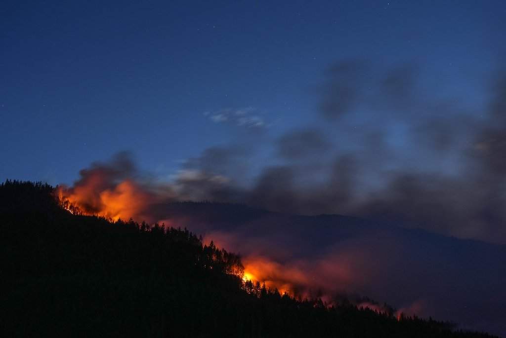
The air smells like burning pine and wet copper.
You stand on a gravel ridge three miles out, but the heat still finds you, sticking to your face like a warm, wet towel. Ahead, a wall of flame bites through the dry underbrush of the valley floor. It is massive, terrifying, but expected. Fires burn. That is what they do.
Then, the smoke stops drifting.
Instead of spreading sideways across the horizon, the thick plume begins to twist upward, hammering straight toward the stratosphere like a black pillar holding up a darkening sky. Within twenty minutes, the blue sky vanishes. A massive, cauliflower-shaped cloud blooms above the inferno, turning from brilliant white to deep, bruised purple.
Lightning flashes inside the dark mass. Not down from the heavens, but sideways, cracking within the smoke itself. A low roar begins—not the crunch of burning timber, but the deep, hollow resonance of a jet engine firing up right beside you.
The forest fire didn't just grow. It birthed a storm.
The Engine in the Ash
To understand how a terrestrial blaze turns into a meteorological monster, you have to forget everything you learned about benign rain clouds.
Normal thunderstorms are born when the sun warms the Earth's surface, heating the air directly above it. That warm air, lighter than the cold air above, rises. As it ascends, it cools, moisture condenses, and a cloud takes shape.
A wildfire skips the slow burn of the afternoon sun. It acts like a massive thermal engine dropped directly onto the forest floor.
When a high-intensity fire reaches thousands of degrees, it superheats millions of cubic feet of air every second. This air becomes hyper-buoyant. It rockets upward at speeds exceeding eighty miles per hour, dragging ash, charred debris, and water vapor torn straight out of the burning vegetation along for the ride.
Scientists call this column a pyrocumulus cloud. When the energy is extreme enough, it ascends high into the troposphere—sometimes reaching six or seven miles into the atmosphere—and transforms into a pyrocumulonimbus: a fire-triggered thunderstorm.
Inside this column, physics goes chaotic.
As the hot updraft violently violently smashes into the freezing temperatures of the upper atmosphere, the moisture carried up from the burning plants freezes instantly into ice crystals. Millions of tiny ice particles and soot bits collide at terrifying speeds, swapping electrical charges like socks rubbing against a carpet. Positive charges gather near the top of the cloud; negative charges collect near the base.
The tension builds until the air can no longer hold it back.
Lightning rips through the soot.
It is a cruel, self-reinforcing cycle. The very heat generated by the burning earth creates the lightning, which strikes miles away in dry brush, starting new, secondary blazes before the main fire front even arrives.
The Sky Draws a Breath
If the lightning feels like a cruel twist of nature, the wind that follows feels almost calculated.
Standing near a developing fire storm, the first thing you notice isn't the heat; it's the sudden, bizarre change in the breeze. The air surrounding the fire stops blowing away and begins rushing toward the center of the flames.
The monstrous updraft sucking air miles into the sky creates a powerful low-pressure void at ground level. Nature hates a vacuum. To fill that sudden empty space, air from miles around is drawn inward with violent force.
This is where the fire begins to generate its own weather patterns.
As these inward-rushing winds collide from different directions around the base of the updraft, they begin to spin. The conservation of angular momentum takes over—the same physical law that makes a figure skater spin faster when they pull their arms inward.
The spinning column tightens. The flames follow the air upward.
A pyrotornado is born.
Unlike standard tornadoes, which form from atmospheric rotations high above and stretch downward to touch the earth, a fire whirl builds from the ground up. The core of the vortex can reach temperatures over two thousand degrees Fahrenheit. It doesn't just knock over trees; it acts as a massive blowtorch, lifting burning logs, embers, and molten material hundreds of feet into the air and hurling them into untouched wilderness.
The Rain That Never Touches the Ground
There is a moment during a fire thunderstorm when you might look up at the dark, heavy clouds and feel a flicker of hope. Clouds mean rain. Rain means relief.
The sky opens up, but the relief never arrives.
As water vapor inside the pyrocumulonimbus condenses, heavy rain drops begin to fall. But as they drop into the superheated, bone-dry layer of air just above the blaze, something brutal happens. The rain evaporates long before it hits the soil.
Meteorologists call this virga.
When that rain evaporates in mid-air, it cools the surrounding atmosphere instantly. Cold air is heavy and dense. Instead of gently settling, this mass of chilled air drops like a concrete block through the rising heat, crashing straight down onto the forest floor.
This is a dry microburst.
When that falling column of air hits the ground, it explodes outward in every direction, fanning the flames with hurricane-force gusts. A fire crew standing on the front lines suddenly finds the fire shifting directions instantly, driven by fifty-mile-per-hour winds dropping straight out of a cloud that refused to give them a single drop of water.
Standing on the Shifting Line
The terrifying reality of fire-generated weather isn't found in satellite images or atmospheric pressure diagrams. It is found in the eyes of the people tasked with fighting it.
For decades, wildland firefighting was built on predictable rules. You watched the topography. You tracked the ambient humidity. You measured the prevailing winds. You built your firelines where the terrain gave you an advantage.
Fire storms throw those rulebooks into the blaze.
When a wildfire generates its own weather, it operates on a localized system completely divorced from the regional forecast. It creates its own wind speed, its own wind direction, its own ignition sources, and its own atmospheric instability. It transforms a grounded tactical problem into an unpredictable airborne assault.
We are entering an era where these atmospheric monsters are no longer rare anomalies tucked away in remote regions of the globe. They are becoming recurring characters in our dry seasons, fueled by hotter seasons, denser underbrush, and prolonged droughts.
Understanding them is no longer an academic exercise reserved for atmospheric physicists. It is a vital necessity for anyone living anywhere near a dry forest line.
The fire is no longer just sitting on the ground, waiting for us to put it out.
It has learned how to reach into the sky, take a deep breath, and fight back.