The spatial configuration of Neolithic monuments on the Salisbury Plain is governed by a predictable astronomical baseline, not isolated bursts of structural innovation. The identification of a 5,000-year-old timber assembly at Bulford, situated exactly five kilometers east of Stonehenge, establishes a clear technological lineage for prehistoric solar observation. Radiocarbon data positions this timber alignment at approximately 2950 BCE, predating the installation of the iconic sarsen trilithons by half a millennium. By deconstructing the Bulford site, we map the precise technological scaling, spatial optimization, and resource investment strategies that laid the groundwork for the world’s most famous megalithic complex.
The Geodetic Blueprint: Mechanics of the Two-Post Alignment
Monolithic stone circles represent an advanced phase of architectural engineering, but their core utility relies on data gathered from simpler, highly accurate instruments. The Bulford monument functioned as a long-baseline optical sight. The architecture did not rely on complex geometric enclosures, but rather on two massive timber posts set exactly 120 meters apart.
To evaluate the efficiency of this baseline, consider the geometric relationship between the height of the markers and the distance separating them. Excavation metrics reveal post pits dug to a depth of one meter, indicating that the timber pillars stood between three and four meters above the surface. Sunk into a calculated hillside position, these two vertical markers operated as a structural gunsight.
[Sun Position at Solstice] ------> (Post A: 3-4m) ===== 120 Meters =====> (Post B: 3-4m) ------> [Observer Baseline]
This 120-meter separation significantly reduces user tracking error. When tracking the solar disk across a horizon, a short distance between two markers increases the margin for visual misalignment. By expanding the baseline to 120 meters, the Neolithic builders minimized angular error, ensuring that the visual vector between the posts locked precisely onto two distinct annual coordinates:
- The Summer Solstice: The azimuth tracking the exact point of the rising sun on the longest day of the year.
- The Winter Solstice: The corresponding inverse alignment tracking the setting sun on the shortest day of the year.
Digital skyscape reconstructions modeling the night skies over Wiltshire in 3000 BCE confirm that the axial orientation of the Bulford posts matches the solar path of the period. This confirms that the site served as an active, high-precision observatory long before the first sarsen stones were hauled from the Marlborough Downs.
Resource Allocation and Logistics Scaling
The transition from the Bulford timber baseline to the definitive Stonehenge stone circle illustrates a massive escalation in labor requirements and energy expenditure. We can model this architectural evolution through a simple logistical cost function:
$$\text{Total Investment} = \text{Material Mass} \times \text{Transport Distance} \times \text{Labor Density}$$
Evaluating both sites through this framework clarifies the operational shift between early and late Neolithic construction.
The Timber Phase (Bulford Paradigm)
The initial capital layout at Bulford was lean and highly optimized. The raw materials consisted of local hardwood timber, likely oak, sourced from nearby forests. Sinking two deep pits and raising poles required minimal labor forces, probably native to the immediate Salisbury Plain. The site could be fully deployed within days by a single extended community group.
The Megalithic Phase (Stonehenge Scaling)
The final iteration of Stonehenge required a total restructuring of regional labor. The material mass scaled from a few tons of timber to thousands of tons of rock. Transport distances escalated exponentially, requiring the movement of smaller bluestones from the Preseli Hills in Wales (over 200 kilometers away) and massive sarsen boulders from a distance of 30 kilometers. The labor density moved from localized community efforts to an organized regional network capable of sustaining thousands of workers over multiple generations.
The structural variance between the two sites proves that the cognitive framework of solar alignment was fully mature at 3000 BCE. The builders did not alter their astronomical principles over the subsequent 500 years; they merely upgraded their material medium from degradable organic wood to permanent geological stone.
Socio-Economic Catalysts: The Gathering Infrastructure
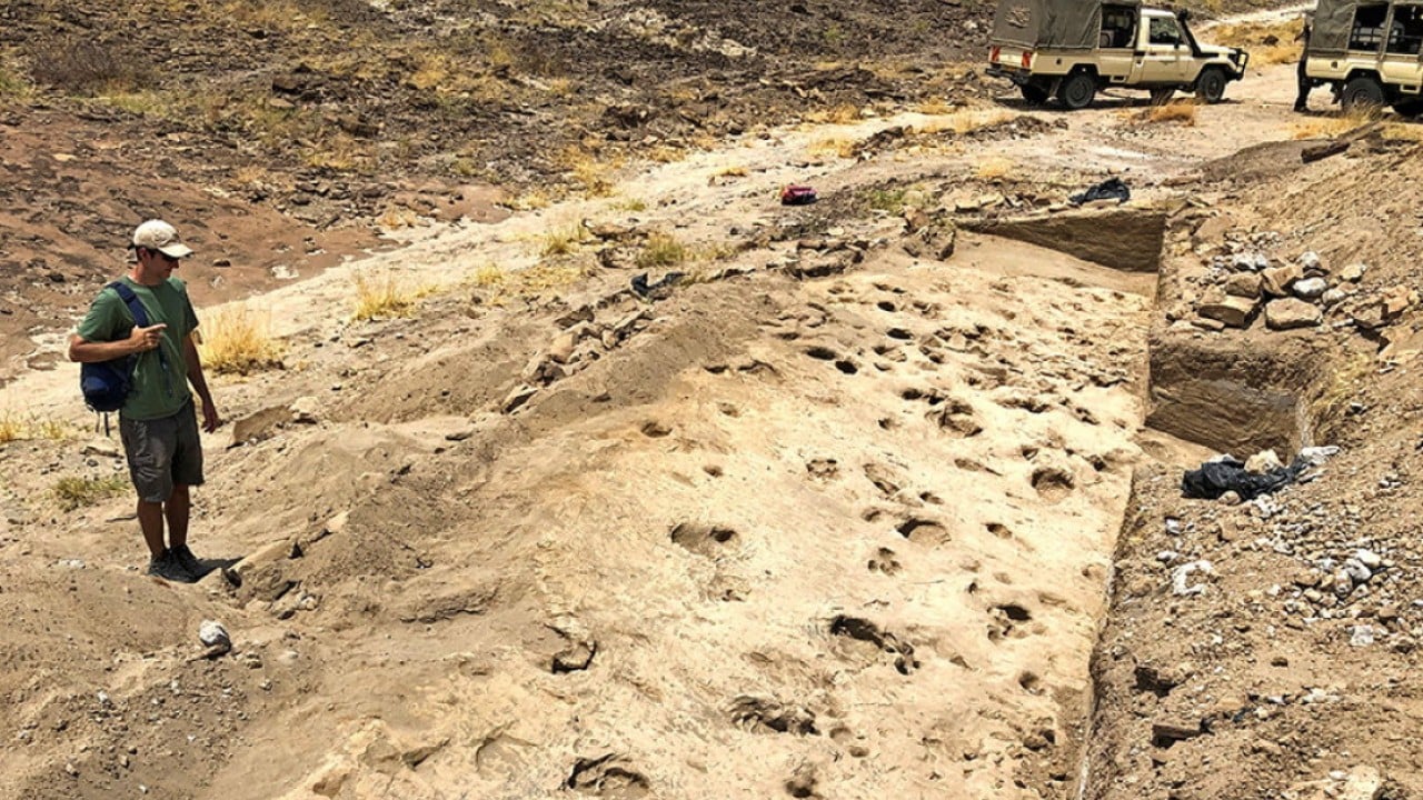
The archaeological evidence recovered from Bulford refutes the idea that early astronomical sites were isolated observation towers used only by elite specialists. Excavation of a 13-hectare zone surrounding the solar axis revealed a dense network of 48 distinct refuse pits.
The contents of these pits provide an empirical index of human behavior at the site:
- Faunal Remains: Large volumes of animal bones showing butchery marks, indicating systematic livestock slaughter for mass consumption.
- Ceramic Fragments: Grooved ware pottery shards associated with food preparation and communal serving.
- Lithic Assets: High-quality worked flints, including a highly polished, rare disc-shaped flint knife used for precise cutting tasks.
- Charcoal Deposits: High concentrations of carbonized wood, pointing to large-scale hearths maintained over short, intense periods.
The data points to a highly cyclical utilization pattern. The lack of permanent domestic foundations indicates that Bulford was not a permanent village, but a high-capacity seasonal convergence hub. The coincidence of intensive food consumption, tool maintenance, and charcoal deposition suggests that populations converged on the site to coincide with the solar events tracked by the timber poles.
This model indicates that solar tracking served a vital administrative function. In an agrarian or transitional pastoralist society, tracking the solstices established a reliable calendar. This temporal anchor coordinated tribal movements, managed livestock breeding cycles, and scheduled regional trade gatherings.
Systemic Vulneracies in the Archaeological Record
While the Bulford discovery fills a critical gap in the architectural timeline of the Salisbury Plain, it highlights the preservation biases inherent in modern archaeology. Timber structures possess a finite lifespan before rot compromises structural integrity.
The primary limitation in analyzing timber-based landscapes is the complete disappearance of organic material. Unlike stone, which remains static across millennia, a timber post leaves behind only a negative footprint: a circular zone of disturbed, darker soil where the wood rotted in place, surrounded by secondary backfill.
The Bulford site remained undetected for thousands of years because its surface signature was entirely erased by centuries of agriculture and military use on the Salisbury Plain. The discovery was only made possible by mandatory commercial mitigation archaeology conducted ahead of a Ministry of Defence housing development. This reveals a distinct structural bottleneck: our current maps of prehistoric landscapes are heavily biased toward stone architecture simply because stone survives. The true post-glacial landscape was likely dominated by complex, long-baseline timber networks that have been entirely obliterated by topsoil plowing.
The Micro-Migration Construction Hypothesis
The temporal alignment of the Bulford site introduces an operational link to the initial construction phase of Stonehenge. Radiocarbon testing places the active use of the Bulford pits at 2950 BCE. This dates to the exact period when the outer circular earthwork ditch and banks were being excavated at Stonehenge itself.
This overlapping chronology suggests a compelling operational model. The labor crews tasked with digging the massive initial enclosures at Stonehenge required regional support hubs. The presence of high-density cooking debris and tool manufacturing waste at Bulford, located just a short march away, supports the hypothesis that Bulford functioned as a strategic base camp or residential support sector for the workforce building the primary phase of the main monument.
The two sites should not be viewed as competing centers, but as integrated components of a single, coordinated regional design. The solar alignment at Bulford provided the astronomical validation, while the early works at Stonehenge prepared the ground for the permanent stone temple that would eventually centralize the entire system.
Strategic Archeological Recommendation
To map the full extent of this prehistoric infrastructure, landscape analysis must shift away from isolated monument excavations and move toward systematic deep-soil subsurface imaging. The discovery of the Bulford alignment confirms that high-precision astronomical instruments were deployed across the Salisbury Plain centuries before the construction of stone circles. Future field resources must be directed toward magnetometry and ground-penetrating radar corridors connecting known stone sites. This approach will allow researchers to identify remaining timber post-hole networks, ultimately revealing the complete, interconnected prehistoric grid.