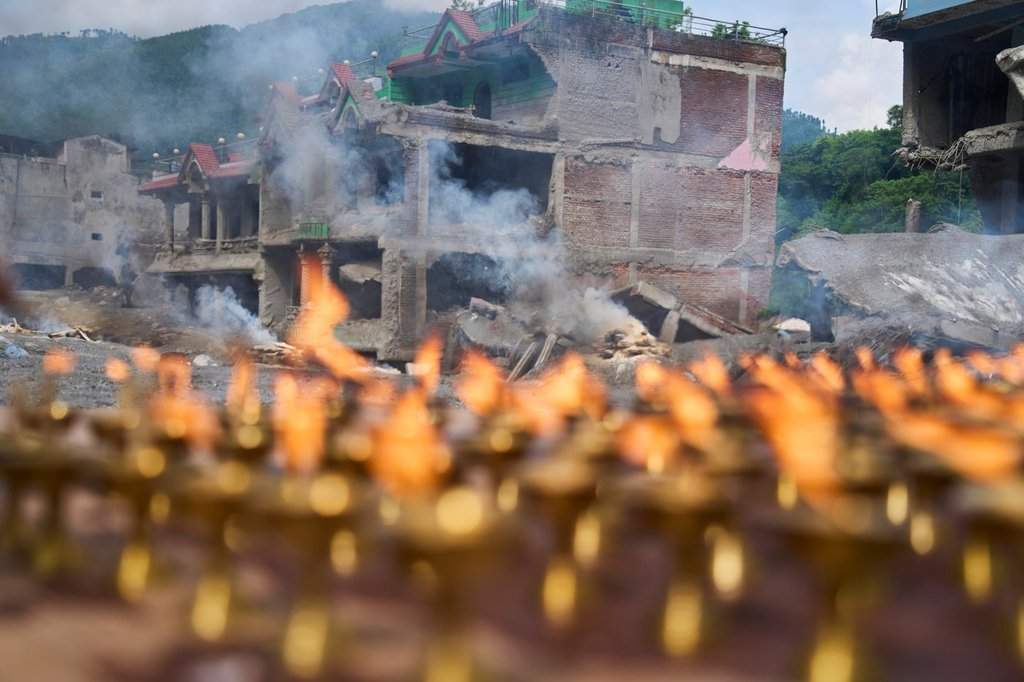
Standard disaster reporting reduces high-altitude mass casualty events to meteorological anomalies and human grief. When an ice-rock avalanche and subsequent flash flood cascaded down the Langtang Lirung sector across the Nepal-Tibet border, conventional media focused exclusively on the human cost and immediate rescue bottlenecks. The structural failure runs deeper than rising temperatures or delayed heavy machinery. The disaster represents a systemic breakdown across three distinct domains: geophysical monitoring limitations, structural vulnerability within concentrated industrial corridors, and the economic friction of transboundary disaster response. Deconstructing this event requires analyzing the operational mechanics that transformed a remote alpine destabilization into a multi-billion-dollar humanitarian crisis.
The Geophysical Mechanics and Sensor Failure
The precipitating event on August 26, 2026, originated not from standard monsoon saturation, but from an ice-rock avalanche and glacier collapse. Seismometers globally detected a magnitude 5.2 signature, illustrating the colossal kinetic energy released at the border. Traditional flood early warning systems deployed across the Himalayas are engineered around specific failure modes, predominantly perennial river swelling or standard glacial lake outburst floods characterized by gradual volumetric accumulation. Discover more on a related subject: this related article.
These monitoring arrays rely on water level sensors and downstream acoustic meters designed to track progressive phase changes in hydrological flow. An ice-rock avalanche introduces an entirely different vector profile. It combines solid mass displacement with instant fluid translation, generating a debris flow that behaves closer to a liquid landslide than a standard river flood.
[Glacier Collapse / Ice-Rock Avalanche]
       ↓ (Kinetic Energy / Seismic Shift)
[Upstream Monitoring Station Destruction]
       ↓ (Sensor Failure / Zero Latency Warning)
[High-Velocity Debris Surge in Narrow Gorge]
       ↓ (Infrastructure & Industrial Impact)
The upstream monitoring stations were pulverized instantly by the initial kinetic impact, severing telemetry before data packets could clear the local network. The technical limitation lies in sensor survivability. Systems optimized for hydrostatic pressure measurements lack the structural hardening required to withstand high-energy mass movements. Without telemetry survivability at the point of origin, downstream communities and industrial assets operate in a binary state of normal operations or catastrophic impact, completely bypassing the intended window for active evacuation. More journalism by The Guardian highlights similar perspectives on this issue.
The Industrial Vulnerability Matrix
The concentration of fatalities and missing persons—particularly the approximately 900 missing workers and trapped individuals across targeted hydropower projects—exposes a critical flaw in high-risk infrastructure siting. Energy generation demands proximity to high-gradient river systems, placing heavy civil engineering works directly inside high-velocity floodplains and narrow gorges.
Hydropower tunnels function as hydraulic funnels during standard operations, but in a debris-flow scenario, they transform into dead-end traps. When millions of tons of mud, ice, and boulders breach a river corridor, subterranean or semi-subterranean project housing becomes structurally compromised before evacuation protocols can be executed manually.
The economic cost function driving this vulnerability balances the cheap generation potential of high-altitude river drops against the catastrophic tail risk of low-probability, high-severity geological events. Standard risk-assessment models underestimate high-velocity debris flows because historical recurrence intervals span decades or centuries. Consequently, asset operators design structural safeguards around 50-year or 100-year flood lines rather than worst-case mass-wasting events. When an avalanche-induced surge exceeds these engineered tolerances, the physical assets fail completely, leaving workers trapped inside underground infrastructure where heavy machinery cannot be deployed rapidly.
Transboundary Information Friction
Geopolitical boundaries create friction in disaster response, particularly in shared river basins originating in high-altitude regions like the Tibet Autonomous Region and flowing into Nepal. Hydrological data sharing relies on diplomatic frameworks that prioritize bureaucratic verification over real-time operational telemetry.
When an anomaly occurs at high altitude near border checkpoints like Gyirong Port, the immediate dissemination of seismic or hydrological anomaly data faces institutional latency. Even with bilateral cooperation between Chinese and Nepali scientific agencies, automated cross-border alerting architectures are frequently bottlenecked by security protocols and verification chains.
Rescue logistics face symmetrical friction. Heavy recovery operations in remote Himalayan terrain require specialized heavy-lift rotary-wing aircraft capable of operating at high altitude. Local aviation assets in landlocked developing nations possess strict density-altitude operating ceilings and limited fleet sizes. Procuring international heavy-lift assets requires diplomatic clearance, logistical staging, and inter-agency coordination that consumes critical windows during the golden hours of search and rescue operations.
Systemic Resilience Reengineering
Mitigating future catastrophic failures along fragile Himalayan corridors demands a shift from reactive humanitarian mobilization to proactive physical hardening. Sensor networks must transition from vulnerable surface water monitors to distributed seismic-acoustic arrays capable of detecting sub-surface mass movement before structural collapse reaches the riverbed.
Industrial project design rules within high-gradient river valleys require strict mandates for above-grade residential quarters and multi-tiered evacuation routes that do not rely on subterranean access tunnels. Furthermore, transboundary data-sharing protocols must be fully automated, bypassing bureaucratic verification chains to feed raw sensor metrics directly to automated siren systems in downstream settlements.
Regional governments and international financial institutions must factor high-altitude climate risks into the cost of capital for mountain infrastructure. Without structural adaptation, economic expansion into high-gradient river basins will continue to externalize climate and geological volatility directly onto vulnerable workforces and communities.


